Click to view map store main page A Maps & Graphics Co.  Maps that mean business since 1985

         OFFICE WALL MAPS MAP DOWNLOADS CUSTOM MAPS ABOUT/CONTACT REVIEWS

FREE SHIPPING Sitewide!

You can call and speak with an actual live person.
770-443-8808
M-F  9:00am-6:00pm EST USA
To verify or place an order you can also
email us.  
If you need a quote on a custom map, just send us your specs and we will get back to you with a quote and sample images.


LARGE UNITED STATES MAPS
The most detailed USA wall map
!

REGIONS OF USA DETAILED MAPS

United States COUNTY/CITY SERIES
MARKET MAPS

U.S. REGIONS SALES/MARKETING COUNTY/CITY WALL MAPS

ATLANTA & GA AREA WALL MAPS

Hardcopy WALL MAPS are
STILL important for business

WORLD WALL MAPS

CUSTOM MAP DESIGN

BUSINESS WALL MAPS

STATE WALL MAPS

Digital map images

Download Maps on sale 50% off! Regular $19.95  only $9.95  for any digital map!
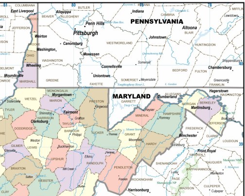
Choose from  styles / choice of colors for printable maps that make impressive professional reports and  presentations.
High resolution map images:
United States
USA Regions
all US States
Continents
World
Countries
Digital image files of white or color maps for business  presentations, projector screen, added to your company website, printing in a brochure or annual report, for study, school or home classroom. Colorful maps also make useful and attractive home, home office and office decor.

We are always adding more digital maps, so if you need an area that has not been added to purchase as a download on our website, please
contact us and if we have it, we can either add a page or email you a file.
If we do not yet have a digital map of your required area we might be persuaded to add it to our current  production schedule.
Outline maps are
free downloads.

ZIP CODE MAPS

WORLD REGIONS

West Virginia MAP COLOR COUNTIES and TOWNS 
Cleartype -  Sales / Marketing map of West Virginia State
Digital Image files that download to your computer - print out maps of West Virginia counties and towns

How to use the map image files...

MAPS CAN BE INSERTED INTO WORD Processing, POINT PRESENTATION PROGRAMS, AND DESKTOP PUBLISHING. EASILY OPENED/IMPORTED IN MANY
IMAGE EDITING, PHOTO, OR PAINT TYPE PROGRAMS.
MOST PROGRAMS...FILE-IMPORT, OR INSERT-PICTURE.
TO BE SURE SIZE FITS THE PAGE, SCALE WITH AN IMAGE EDITOR...
OR ...
SET MAP TO PRINT "FIT TO PAGE" IN YOUR PRINTER'S SETTINGS MENU.  
RASTER IMAGE FILES - NOT FULLY EDITABLE


Disclaimer...
TO IMPORT INTO YOUR PROGRAMS PLEASE CHECK YOUR SOFTWARE DOCUMENTATION FOR INSTRUCTIONS BECAUSE

**WE ABSOLUTELY CANNOT PROVIDE TECHNICAL SUPPORT, RETURNS, OR REFUNDS ON DOWNLOADED MAPS.**

IF THERE IS A PROBLEM WITH THE MAP FILE, DOWNLOAD ONE MORE TIME AND BE SURE THE DOWNLOAD WAS COMPLETE, THEN IF NECESSARY CONTACT US BY EMAIL FOR A REPLACEMENT FILE.
PLEASE LET US KNOW IF THERE IS A MAJOR ERROR ON A MAP - (NOBODY'S PERFECT) WE WILL MAKE THE NECESSARY CORRECTION and SEND YOU A CORRECTED VERSION.
THANKS!

THE IMAGE HERE IS A SECTION SAMPLE ONLY TO SHOW THE MAP DETAIL, WITH A RESOLUTION AT
72 DPI FOR INTERNET / WEBSITE USE...

THE MAP TO BE DOWNLOADED WILL BE 
300 DPI- 4 TIMES HIGHER... FOR DETAIL & CLARITY WHEN PRINTED AT STANDARD PAGE SIZE, A RASTER IMAGE FILE IN VERSATILE .JPG FORMAT
UNLIMITED USE...ONLY $19.95

Please read  important information...
like what happens when you press download, file delivery, license agreement, usage terms and all that...  


click here
  DOWNLOAD INFO & AGREEMENT

back to WEST VIRGINIA MAPS main page...


YOU MAY WANT TO TRY USING THE 
FREE OUTLINE MAP 
AS A TEST, SEE HOW THE MAP PRINTS AND WORK IN YOUR PROGRAMS...

Hardcopy...
ALL OF OUR DIGITAL MAPS ARE AVAILABLE AS QUALITY PRINTS, MOUNTED PIN-BOARD, LAMINATED
& FRAMED IN CONTEMPORARY METAL MOLDING IN YOUR CHOICE OF gold, silver or black. Custom woods also avail
APPROXIMATE SIZE 18X24" 
SPECIAL -  mapwench@gmail.com
$129.00 INCLUDES CRATING AND SHIPPING For a Limited Time 
(in Continental USA only)
 print your logo or title on the map legend free of charge if you email us a good digital file
MAKE GREAT GIFTS

**MAPS ALSO AVAILABLE AS VECTOR FILES IN FULLY EDITABLE LAYERS FOR GRAPHICS USE IN FILE FORMATS LIKE... .CDR, .AI, .EPS, OR .DXF 
FOR INFO ON LICENSING FOR USE OF A VECTOR MAP FILE 
OR WE CAN CREATE A CUSTOM DIGITAL MAP, PLEASE EMAIL YOUR SPECS & REQUEST A QUOTE.

WV02&Attributes=Yes&Quantity=1">


By pressing download you agree to have understood the above stated disclaimer...

back to Maps to Print main page...

Privacy policy
Intellectual Property
Terms / Conditions / Shipping
About/Contact

Some of our clients
Reviews/real customer comments
Sitemap.xml

Maps and website content  copyright A Maps & Graphics Company   online since 1995