|
You
can call and speak with an actual
live person. USA SALES REGIONS DETAILED MAPS
United States COUNTY/CITY SERIES U.S. REGIONS SALES/MARKETING COUNTY/CITY WALL MAPS
Hardcopy WALL MAPS are
Download Maps on sale 50% off! Regular $19.95 only
$9.95 for any digital map! |
If you are looking for the ideal location to grow your
business, Georgia is the place to be. Leading companies not only come to the
Peach State, but they flourish here. In fact, 9 out of 10 Fortune 500 companies
currently have operations in Georgia, and 18 of those companies have
headquarters right here in our Southern state.
So, what draws successful companies to Georgia? The state has a long-standing
reputation not only for its favorable business conditions, but also for how
committed the state is to helping companies grow and expand their business. The
state offers unique resources that companies can take advantage of to innovate
and grow revenue.
Georgia’s partnership approach to economic development, along with its
pro-business environment, world-renowned logistics, and highly-rated workforce
are just a few of the reasons why Georgia is the best choice for businesses
looking to expand or relocate.
"Georgia Department for Economic Development "
https://www.georgia.org
WALL MAP ATLANTA
REGION Business Planning & ZIP code wall map
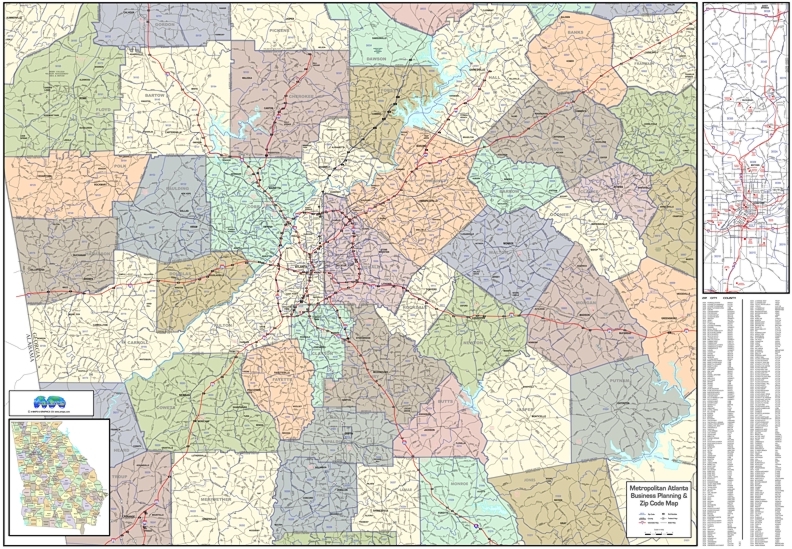
OR Wall Map
ATLANTA METRO REGION - medium size with a
little less coverage
Business Planning & Zip Code Wall Map
Metropolitan Atlanta Region covering over 40 surrounding counties with federal
and state highways, major streets, suburbs, cities / towns, outlines /
boundaries for 5 digit ZIP codes, Interstate hwys with exit numbers, major
landmarks, points of interest, index by city-county-zip code.
STATE MAPS
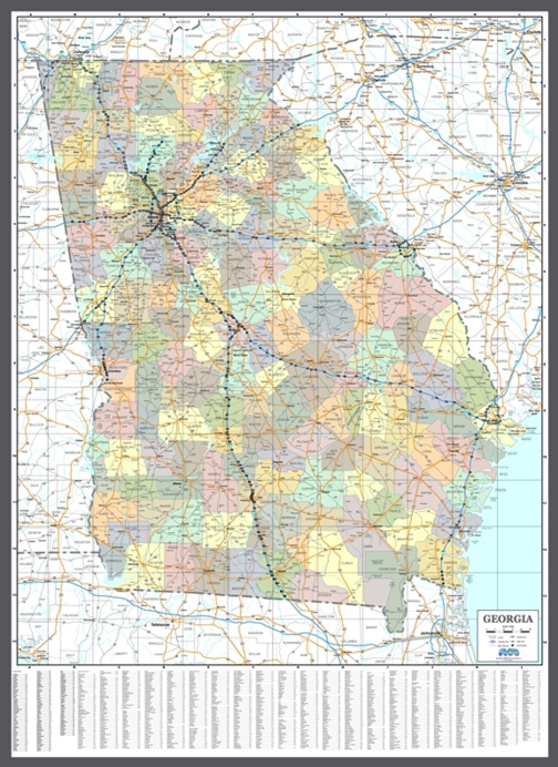
Choose from Georgia Wall Maps showing counties, cities,
highways
and ZIP code boundaries
GEORGIA STATE COMMERCIAL WALL MAP
Copyright A-Maps and Graphics