|
We are an Atlanta, GA
U.S.A. small business, you can call us and actually speak with a
live person
770-443-8808
M-F 9:00am-6:00pm EST
To verify or place an order you can also
email us.
If you need a quote on a custom map, just
send your
specs and we will get back to you with a quote and sample images.
U.S.A. REGIONAL
BUSINESS
MARKET MAPS
DETAILED counties, cities, highways
U.S.A.
REGIONS COUNTY SERIES
SALES/MARKETING WALL MAPS
LARGE UNITED
STATES MAP
The most detailed USA wall map!
U.S.A. COUNTY
OUTLINE
Sales Territory wall maps
ATLANTA & GA AREA WALL MAPS
Hardcopy WALL MAPS are
STILL important tools for business
WORLD WALL MAPS
CUSTOM MAP DESIGN
BUSINESS WALL MAPS
STATE
WALL MAPS
Digital map images...
Download Maps on sale 50% off! Regular
$19.95 only $9.95 for any digital map!
Choose from styles / choice of colors for printable maps that make
impressive professional reports and presentations. High resolution
map images:
United
States
USA Sales Regions
all US States
Continents
World
Countries
Digital image map files in white multi-color, antique style, or
topographic elevation, maps for business presentations, projector
screen, added to your company website, printing in a brochure or annual
report, for study, school or home classroom. Colorful maps also make
useful and attractive home, home office and office decor.
This download section is ongoing. At a somewhat leisurely pace we add
more digital maps from our many titles and areas created over the years,
or create new maps, so if we do not yet have a digital map of your
required area, we can easily be persuaded to add or move that title to
the top of our current production schedule, just
contact us.
or call 770-443-8808
The no text outline maps are all
free downloads.
ZIP CODE MAPS
WORLD REGIONS |
| |
Great Lakes States Regional Maps
Digital Maps for download, high
resolution maps to print in a brochure or report, projector or digital
presentations, post on website, projects, sales meetings. We can also
print, laminate, mount on foam board for pins, and frame to create a custom wall
map of your choice.
Select any of the maps below to see detailed
images and more information for the different styles and background colors
available for Great Lakes Region or more areas.
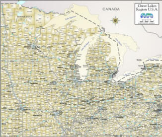
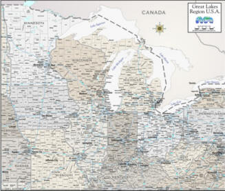
Great Lakes MAP antique style
Counties/cities/highways |
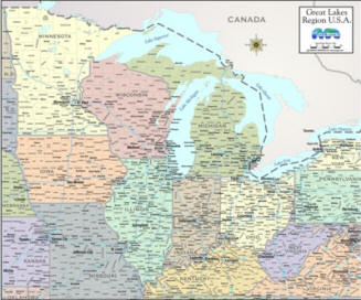
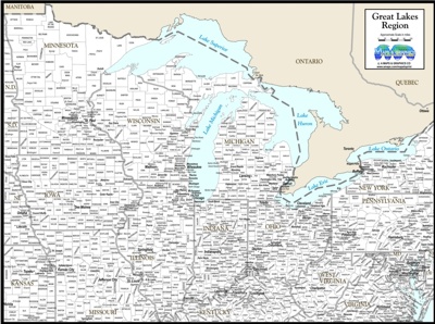
Great Lakes color Counties, Cities and Highways |
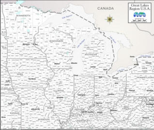
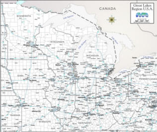
Great Lakes States Map County outline with major cities White |
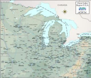
Topographic
Map of Great Lakes with Cities & Interstate Highways |
Cities, counties, highways Great Lakes States Map "greige" |
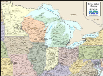
Great Lakes States Map with cities and counties |
Great Lakes Region Map, white Cities and highways |
Great Lakes States COUNTY/TOWN
MAP COLOR by state |

OUTLINE MAP OF Great Lakes States
*FREE DIGITAL MAP* |
|
BUNDLE - All 9 vs
above, (+ bonus map) 9 for the $ of 3... $59.85
Hardcopy...
ALL OF OUR DIGITAL MAPS ARE ALSO AVAILABLE AS
QUALITY COLOR PRINTS, MOUNTED PIN-BOARD, LAMINATED & FRAMED IN YOUR
CHOICE OF VERY NICE WOODEN MOULDINGS. We can also add
your company logo
to your framed map at no charge. These beautiful maps make a unique and
useful promotional gift for clients that keep your brand in view long
term.
APPROXIMATE SIZE 18X24" $189 or 24x32" $249 includes
crating and shipping!
Disclaimer...
TO IMPORT/UTILIZE IN YOUR PROGRAM PLEASE CHECK YOUR SOFTWARE DOCUMENTATION
FOR INSTRUCTIONS BECAUSE
**WE SIMPLY CANNOT PROVIDE TECHNICAL SUPPORT, RETURNS, OR REFUNDS ON
DOWNLOADED MAPS.**
IF THERE IS A PROBLEM WITH THE MAP FILE, DOWNLOAD ONE MORE TIME AND BE
SURE THE DOWNLOAD WAS COMPLETE, THEN IF NECESSARY CONTACT US BY EMAIL FOR A
REPLACEMENT FILE.
PLEASE LET US KNOW IF THERE IS A MAJOR ERROR ON A MAP WE WILL
MAKE THE NECESSARY CORRECTION and SEND YOU A CORRECTED VERSION...back
to mapstoprint main page
WE ALSO HAVE MORE
HIGHLY DETAILED, LARGE LAMINATED WALL MAPS OF SALES REGIONS
|
|