|
We are an
Atlanta, GA U.S.A. small business, you can call us and speak to a
live
person U.S.A. REGIONAL BUSINESS MAPS DETAILED U.S.A. REGIONS CITY COUNTY MAPS LARGE UNITED STATES MAP The most detailed USA wall map!
U.S.A.
COUNTY LINES Hardcopy WALL MAPS important tools for business
Download Maps on sale
40% off! |
WALL
MAP OF NORTHEAST ATLANTIC REGION
BUSINESS MAP FOR MARKETING, SALES & LOGISTICS
Office maps that are both functional and attractive -compare our business wall maps for
quality and detail to any other commercial map publisher...

Our Business Region Wall Maps are printed
as ordered, please allow a couple business days for production and shipping, and the
occasional techno-gremlins
; ) If you have a demanding deadline, call or email,
we've been known to work small miracles and meet them.
ENLARGED SECTION OF MAP TO SHOW DETAIL...
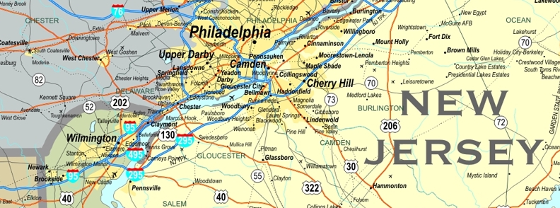
This Northeast is one of our standard sections or market areas from the regional wall map series for in the USA. We can also create your specific sales region if you need a custom multi-state map
**ADD YOUR COMPANY LOGO
OR TITLE TO THE MAP LEGEND AT NO EXTRA CHARGE
SEND A QUALITY DIGITAL IMAGE FILE EMAIL ATTACHMENT
(PRINTABLE RESOLUTION .jpg
or .pdf)
PLEASE TYPE
"MAP LOGO" & YOUR ORDER # IN SUBJECT LINE